bay state commons
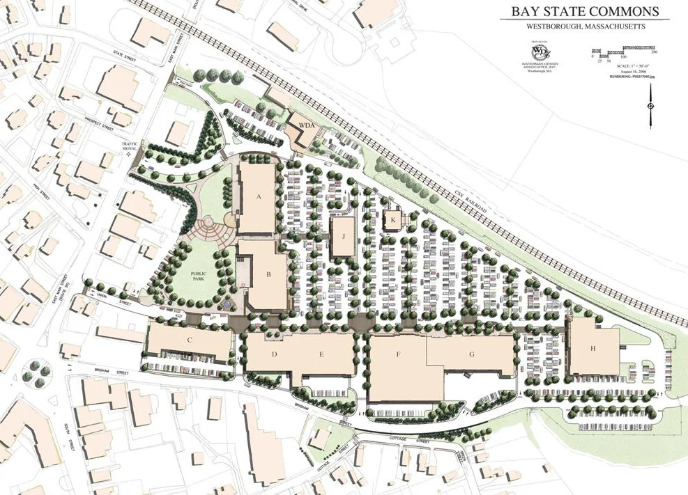
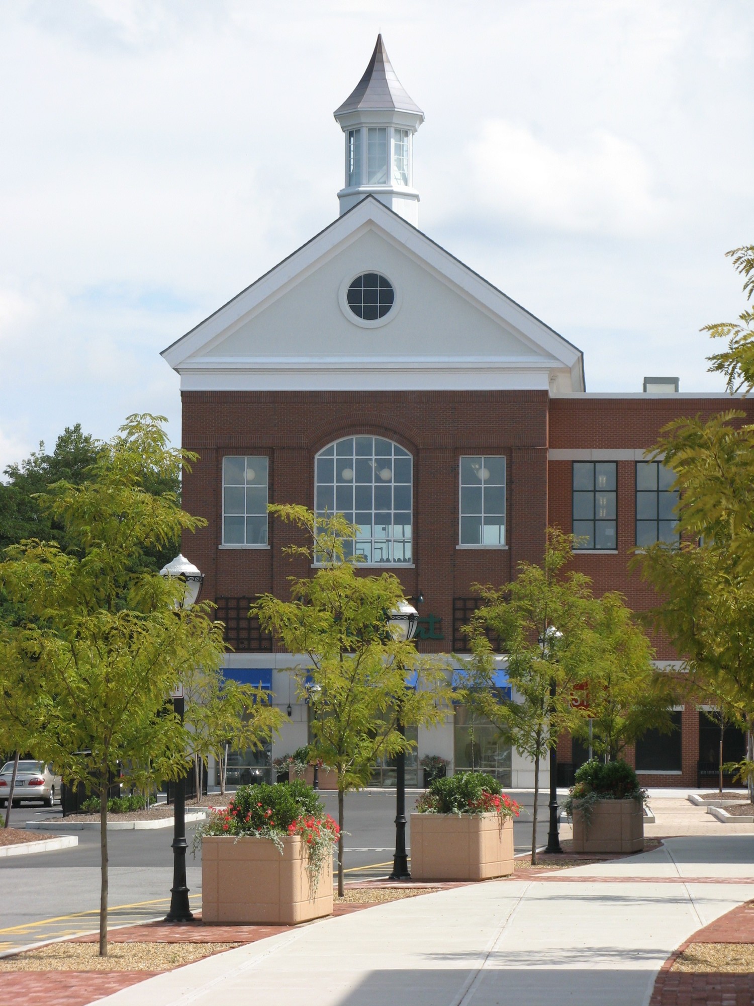
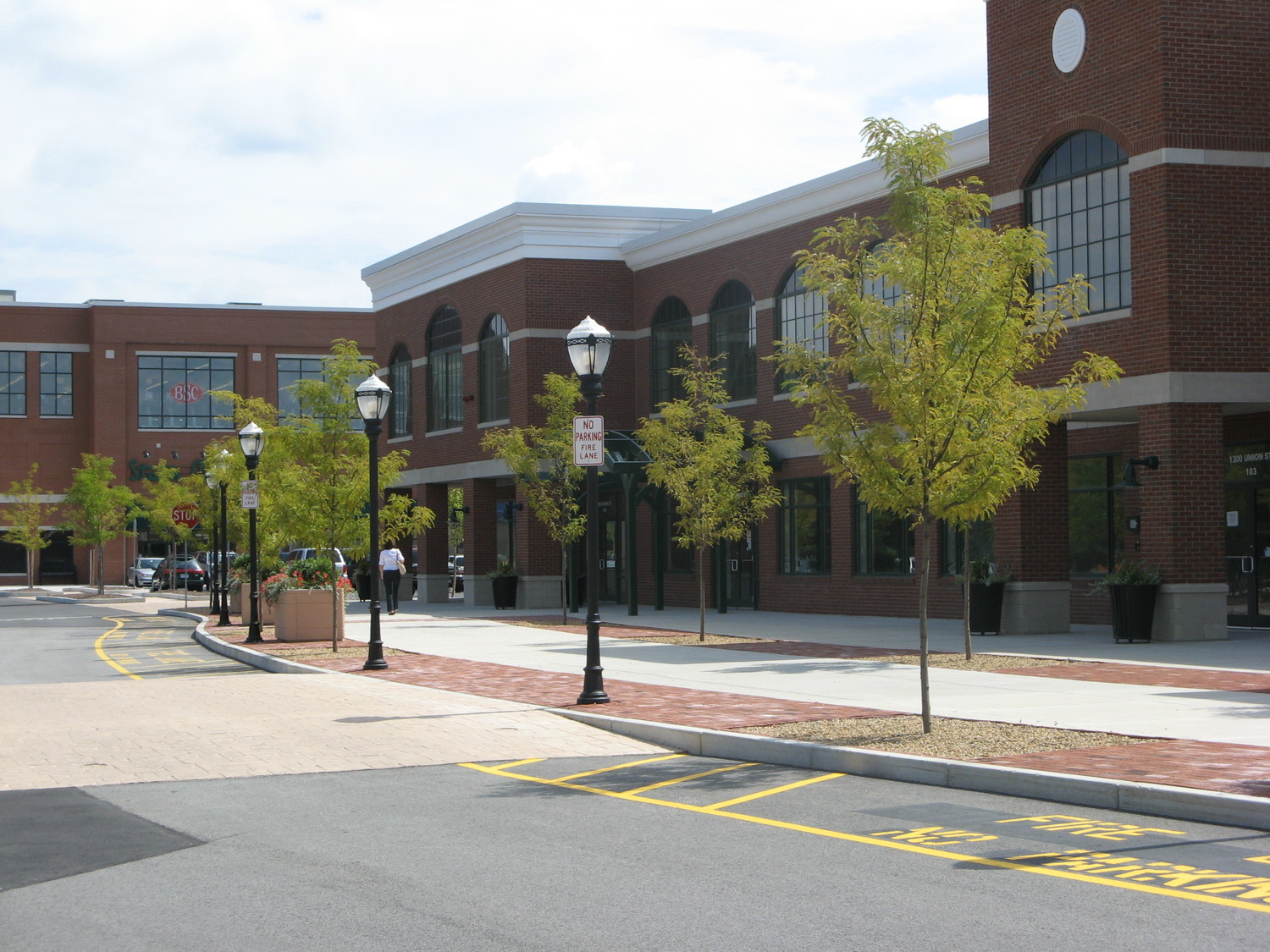
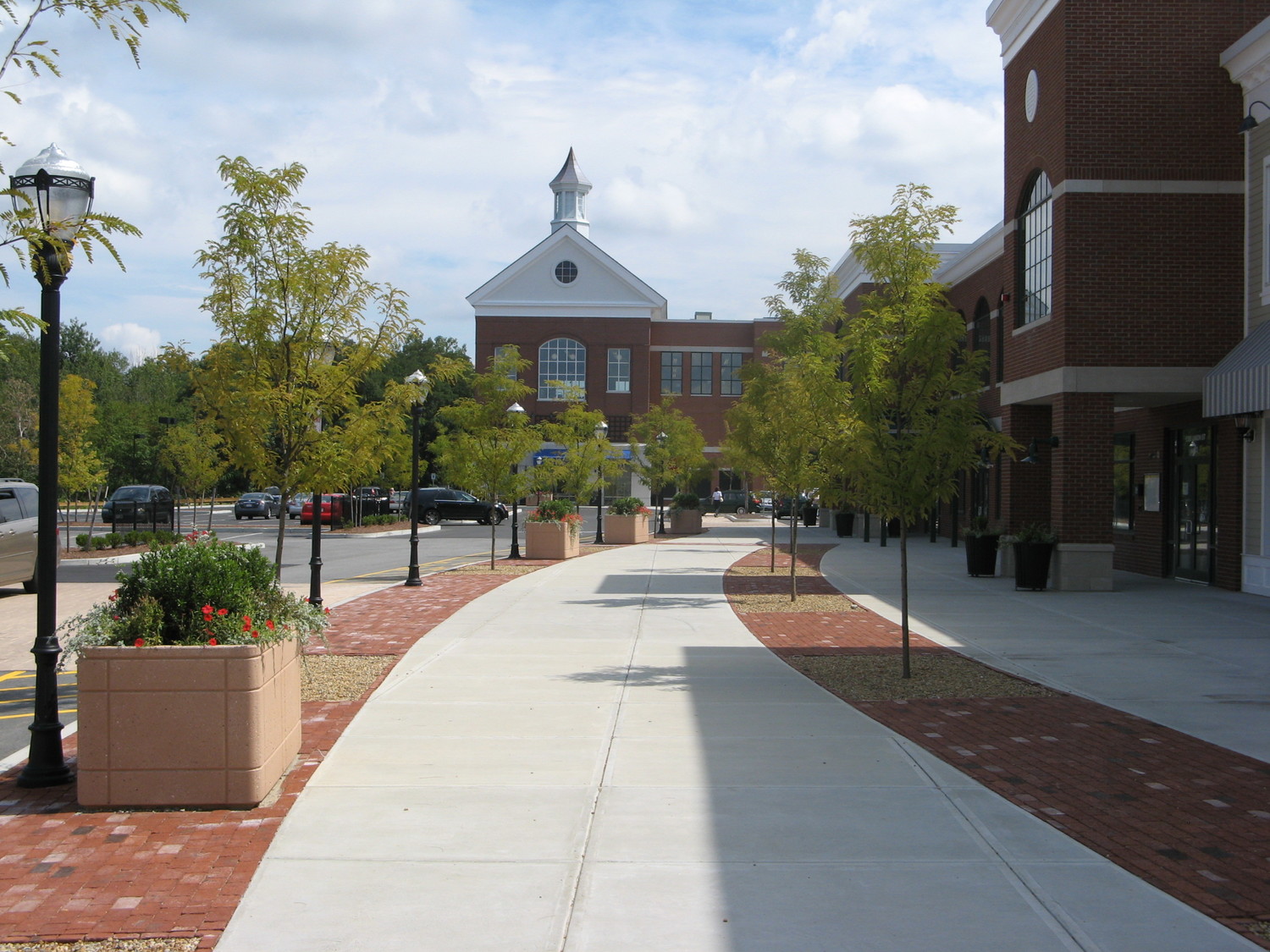
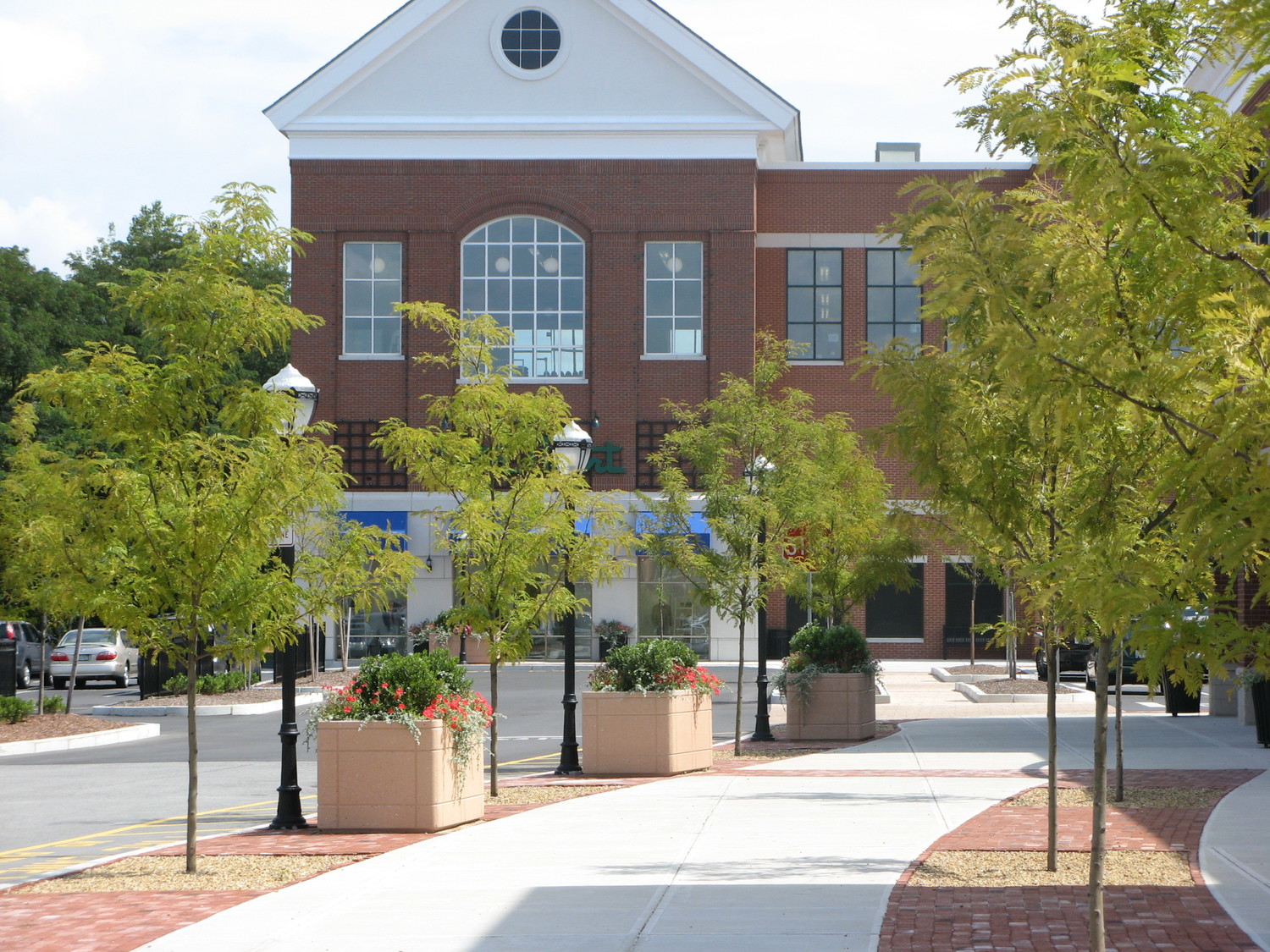
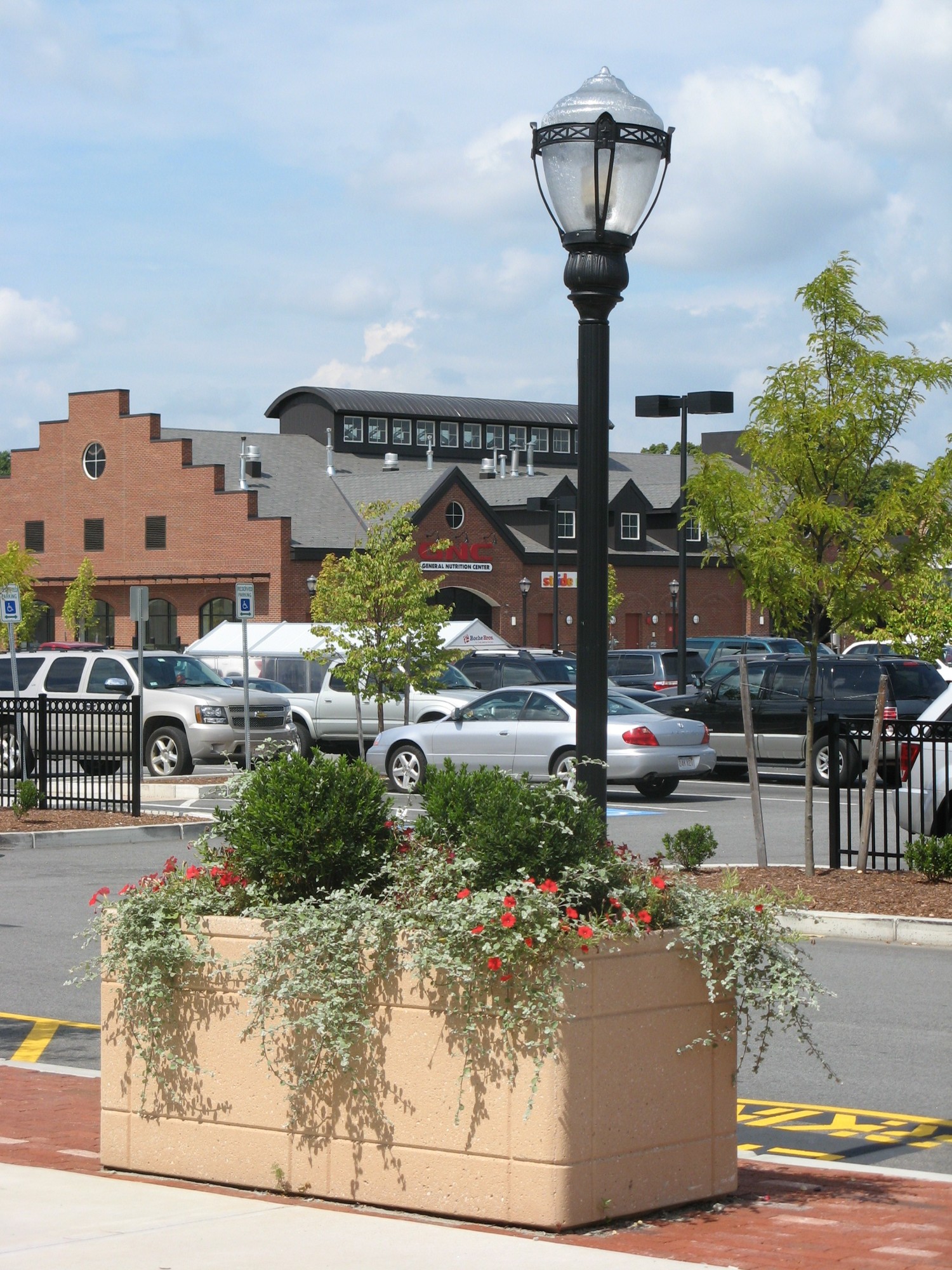
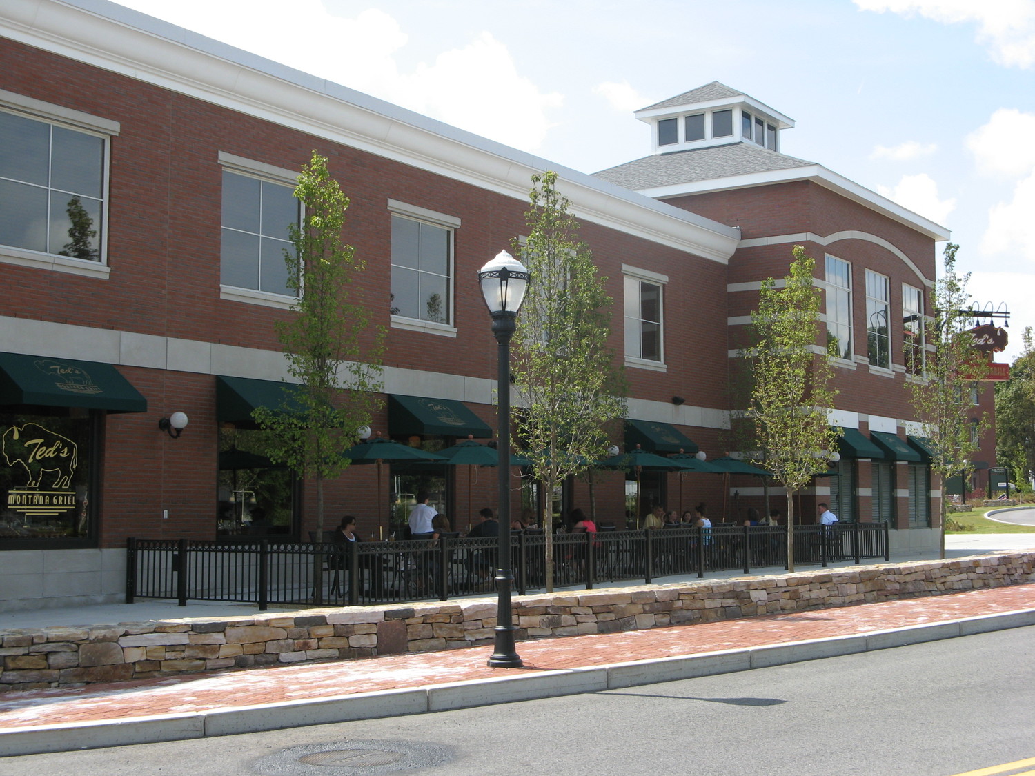
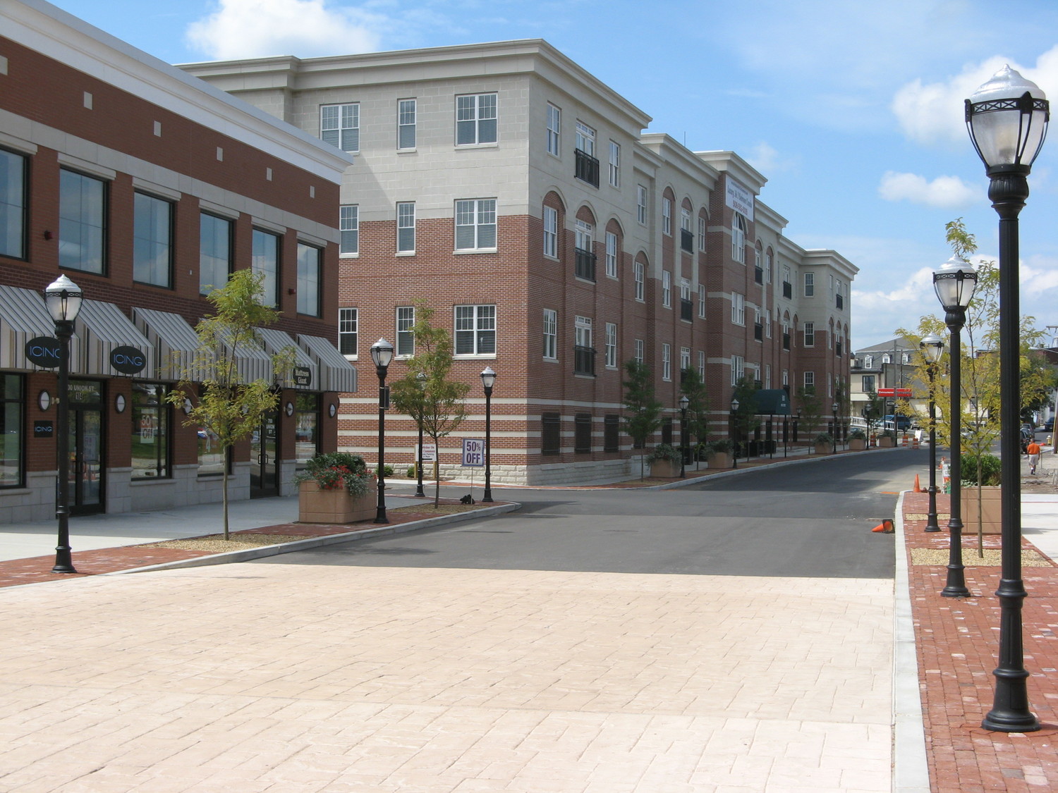
WDA Design Group provided complete planning, design, engineering, surveying, zoning consultation and permitting services for the redevelopment of the former 56-acre Bay State Abrasives industrial complex into a new, state of the art mixed-use “lifestyle” center. The project, which is integrated into the central village in Westborough, MA, directly adjacent to the downtown rotary, is designed to create a vintage “Main Street” shopping experience by developing a unique streetscape and architectural identity that reflects the existing central village community.
The history of the Bay State Commons site, and it's long journey from ecosystem to mixed-use development, is both fascinating and inspiring. The property was formerly a parcel of the Great Cedar Swamp ecosystem. The Great Cedar Swamp consists of approximately 2,000 acres, created over a century ago when the Metropolitan Water Works Commission engaged in a series of land acquisitions aimed at water and resource protection, the accumulation of which became the forethought for the Sudbury River Watershed. The swamp and the high yield aquifer beneath it are a vital water resource for the area. The swamp is listed on the National Register of Historical Places as the Cedar Swamp Archaeological District, with artifacts dating back 9,000 years. The swamp was also Massachusetts' first Area of Critical Environmental Concern (ACEC). In the 1960's, the Metropolitan District Commission sold over 100 acres of the swamp to Bay State Abrasives. Soon after Bay State Abrasives began manufacturing operations at the site, the property was listed on the US Environmental Protection Agency's watch list for contaminated sites, and was ultimately classified as a superfund brownfield site by the Massachusetts Department of Environmental Protection.
The 2002 Westborough Town Master Plan identified the Bay State Abrasives site as its #1 priority for redevelopment. The Master Plan's recommended action stated that the Town should establish a Downtown Planning Overlay District (DPOD) that included the Bay State site. With the technical assistance of WDA, zoning by-law changes were proposed that led to the creation of the DPOD, whose requirements included the issuance of a Special Permit, after Site Plan review through the Planning Board and approval from the newly formed Design Review Board was secured. Upon Town approval and adoption of the DPOD into the zoning by-laws, WDA was retained by the property owner to move forward with the Special Permit process.
In the early stages of the Master Planning process, WDA identified some mitigating issues that would dictate the scope and physical form of the site redevelopment, including vehicular access and building orientation with respect to the existing building footprints. The most important of which, however, was the fact that nearly the entire footprint of the existing industrial buildings were located within an AUL (Activity and Use Limitation) zone. AUL's are the Massachusetts Contingency Plan's (MCP) sanctioned means to establish institutional controls on contaminated real estate. An AUL can be the essential element of a disposal site cleanup alternative that eliminates or minimizes removal or treatment of contaminated media, resulting in potentially very significant cost savings. As such, WDA's site design proposed to leave all of the existing building foundations in place, allowing them to act as a cap, while importing nearly one million cubic yards of fill material to raise the grade of the entire site by over 3 feet. The fill material was then compacted by means of surcharging, which included the temporary installation of large piles of earth over the fill material, whose weight served as a load to accelerate the compression of the fill material beneath it, with the goal of reducing or eliminating the settlement of any structure subsequently built upon it. A series of geopiers were then installed to further support the building foundations. Finally, to the greatest extent practicable, the existing utility infrastructure was reused to minimize disturbance to the subsurface conditions.
Once all the issues and opportunities were identified and addressed, a series of Concept Plans were developed and refined over the course of the ensuing 32 months. As part of the final approved site design, generous 12’-18’ wide sidewalks lined the new buildings, with streetscape edge treatments including brick pavers, large raised planters filled with lush, unique annuals, period lighting, and street trees in oversized tree pits, all designed to create a strong edge condition along the roadways to clearly define the pedestrian corridor. A tree canopy infrastructure was developed and incorporated as a means to define a heirarchy of roadways and pedestrian spaces, and add scale transition and character to the pedestrian spaces between the strictly horizontal parking lots and the vertical building facades. Traffic calming measures such as 20’+ wide raised crosswalks cast in stamped colored concrete further define and enhance the pedestrian-oriented experience.
As part of the overall mixed-use development, which included over 325,000 square feet of retail space as well as a 44 unit luxury condominium development, Westborough Centre Park, a new 2.5 acre public park located outside of the AUL, was designed adjacent to the main entrance to the center. The park design is separated into three distinct areas, all of which are connected by a consistent vocabulary of hardscape materials
DETAILS
Location: Westborough, Massachusetts
Client: Jasco Tool, New York, NY
Completion Date: 2008
PROJECT TEAM
WDA Design Group
Michael Scott - Principal in Charge
Michael Dowhan
Stephen Converse
Joseph Zambuto
Brian Waterman
Gorman Richardson Lewis Architects - Architect
The Geotechnical Group - Geotechnical Engineer
SERVICES PROVIDED
Civil Engineering
Landscape Architecture
Surveying
Master Planning
Wetlands Permitting
Zoning Consultation